
The trip report
Written by OtisSpunkmeyer
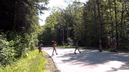
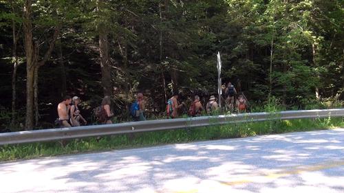
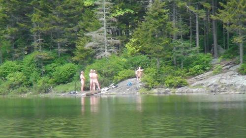
The temp was in the mid 60's and the sky was mostly sunny, perfect for a naked hike. Cars started to arrive around 8:30 with some hikers exiting their cars already naked and ready to go. Cars continued to arrive and by 9:00 am, there were over 30 naked hikers mingling in the trail head parking lot in Danby. Forest rangers drove by, but none stopped. We gathered for a group photo and then most of us car pooled to the trail head east of Wallingford. About 6 of the participants were not able to complete the entire hike, and instead hiked the 2.2 miles to Little Rock Pond where they would wait for the main group to arrive later in the day. Upon arrival at the Wallingford trail head parking lot, we found a small group of people selling snacks and beverages. We received a surprised but warm welcome as about 25 naked hikers exited their cars and greeted the group. After chatting a while with those entreprenuers, packs were donned and the hike began. The group then crossed State Route #140 and began the climb to White Rock Overlook which offered amazing views to the west. As the day progressed, temps rose to the mid 70's with more and more sunshine. The hike continued to Little Rock Pond where the two groups were reunited and the hike resumed back to the trail head parking lot in Danby. Everyone mingled in the parking lot for a while recapping the day before having to get dressed and head home. Some gathered after the hike for Pizza in Manchester, VT where new friends and contacts were made. In all, we encountered a couple other naked hikers as well as a large number of clothed hikers, all of whom gave us a warm and positive reception, with some stopping to chat and get pictures with the group. It was truly a great day and hike and I thank everyone who was able to participate!
Event photos (4)

Reactions
Log in to react to this trip report.
About this event
We will be joining a mixed group that has been doing this hike for years. I first participated 2 years ago, it was sunny and in the 90's and we had 19 people in the group. Last year it was cloudy and in the 60's with only 9 people in the group. Hoping for warm weather once again and an even larger turnout. The total distance covered is approximately 10 miles, should take about 6 hours with stopping for lunch and an afternoon swim, and the elevation gain is approximately 1,300 feet, all within the first 3-4 miles, downhill or after that. We will meet at the trailhead parking lot for the Long Trail on Forest Road 10 east of Mt Tabor at 9:00 am. From there, we will leave some cars at the trailhead and carpool to the trailhead parking lot on Route 140 approximately 3 miles east of Wallingford. Once everyone is ready, the hike will commence. The trail leaves the western side of the parking lot and in a short distance, the trail crosses Route 140. A short distance from there, the trail reaches the Roaring Brook Bridge. After crossing the bridge, the trail ascends beside a dramatic gulch and then enters the White Rocks Recreation Area. Shortly thereafter, the trail crosses Bully Brook. The trail then ascends at a moderate grade and passes the trail junction with the Keewaydin Trail. The trail continues to ascend at a moderate grade and passes the trail junction for the Greenwall Spur. In about half a mile, the trail reaches the junction with the White Rocks Cliff Trail which leads downhill .2 miles to a vista from the top of White Rock Cliffs, where we will stop for lunch. After lunch, we traverse the .2 miles back to the Long Trail where the trail ascends further and passes just to the west of White Rocks Mountain. The trail then begins a steady descent and intersects with the old South Wallingford-Wallingford Pond Road and the crosses the Homer Stone Brook Bridge and later intersects with the Green Mountain Trail. In a short distance, the trail reaches Long Pond and follows it’s eastern shore to the Little Rock Pond Shelter where we will stop for a swim. After the swim, we will continue down the trail which in a short distance intersects with the Little Rock Pond Loop Trail at the southern end of Little Rock Pond. The trail continues almost level and in 1.5 miles crosses Little Black Branch over large rocks and shortly after, crosses it again over an I-beam bridge. The trail then follows an old woods road and shortly reaches Forest Road 10, which we cross to the trailhead parking lot. We stop to rest in the parking lot after which we carpool back to Wallingford to pick up the cars parked there. If there is enough interest, we can stop for a meal in the area and discuss the highlights of the day and make plans for another hike.
Who came along (12)
 GUEST MEMBER
  GUEST MEMBER
  GUEST MEMBER
  GUEST MEMBER
  GUEST MEMBER
  GUEST MEMBER
  GUEST MEMBER
  GUEST MEMBER
Comments
Log in to join the conversation.