
The trip report
Written by gaykilter
We again lucked out with clear weather, sunshine, and cool temperatures. We started out at about 10 a.m. after meeting at the Windham Diner.
Arriving at the parking lot there was a number of cyclists prepping or heading out on the trail. We were a bit surprised to see so many but more on that later.
The area had received some heavy rain in the previous couple of days, so we expected some wet spots. Well, our expectations were a bit understated, because much of the trail was like overcooked oatmeal: a great deal of standing water and very muddy. At times we had to leave the trail to get around the stuff.
The trail is rated as moderate in most guides, and some veterans would actually call it one of the easier of the Catskill trails. I would rate it as high-end moderate as it might prove a bit of a challenge for someone who is at the low end of easy-moderate. There are several respectable inclines that could be scrambles for some. We took it easy; after all, it was a hike, not a marathon.
We passed the Elm Ridge lean-to but didn’t stop. We were enthusiastic about reaching the first of the outlooks with a view to the West and the Blackhead range.
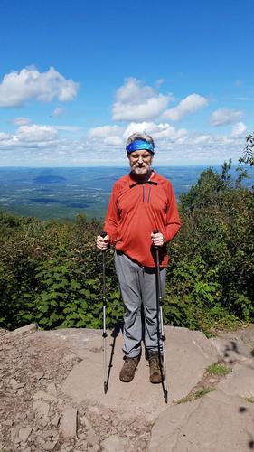
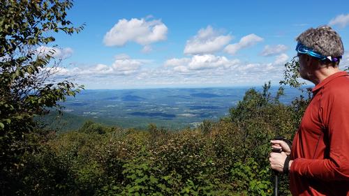
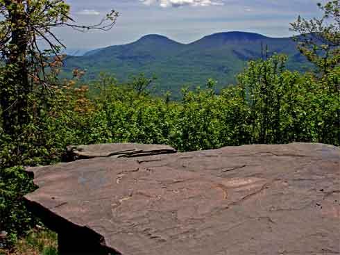
We reached the first outlook to the West, which was unobscured and beautiful summit in about 2 ½ hours. The peaks of the Blackhead range were standing out clear and majestic.
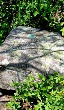
Upon reaching the summit and viewing the USGS markers imbedded in the rocks (there are actually two metal markers at the summit), we continued a bit beyond to a ledge where we could see across the Schoharie and Mohawk Valleys to Albany, with the southern Adirondacks partially visible beyond.
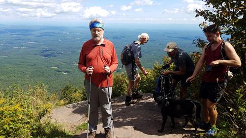
Spending some time on the ledge we were joined by several other hikers who shared our awe.
The down trip was more challenging than the ascent, in my view, but it was faster.
One comment that I feel I should make is about the number of bikes and their effect on the trails.
The trail is typically wet in many places, and in those places where bikes are permitted, they create deep ruts and a nasty mess of mud, making it almost impossible to navigate on the trail and forcing footers to find a way around the mess. There are far, far too many bikes on the trail both in terms of traffic and in terms of the damage they do to the trails. I don’t want to spoil anyone’s outdoor fun but I really do think that the bikes either have to be rerouted to trails of their own or banned outright, except for trail maintenance personnel.
We stopped at the Patisserie Normande, a wonderful French bakery located behind the Windham Diner, and relieved them of several eclairs and other delectible deliacies, and some croissants and a brioche loaf. So who’s watching calories after Windham Peak, anyway?
Finished the wonderful day with a light dinner at the Windham Diner, and headed home. 8 ½ hours of great weather and beautiful sunshine. It doesn’t get any better.
Event photos (5)
Reactions
Log in to react to this trip report.
About this event
Windham High Peak is one of the 35 peaks in the Catskill Mountains that is over 3,500 feet in elevation. Windham High Peak is the most northern of the Catskill high peaks. It towers over other peaks and valleys from various points even though being one of the lowest of the 3500. It is one of the most frequently climbed mountains in the Catskills due to its outstanding views, relative ease, and proximity to a major Catskill tourist town.
The climb involves an ascent of about 1,500 feet in elevation over 3.2 miles. Trail conditions in the Catskills constantly change, so make sure to check the weather report and the condition of the trails before you embark on the hike.
From the parking area, proceed north on the Elm Ridge Trail (yellow-blazed), an old woods road that is often quite wet (short bypass trails have been built around some of the wettest sections). In 0.6 mile, you'll pass a spring (note the pipe on the left side of the trail), after which the trail starts to climb. Soon, you'll pass interesting cliffs to the right and reach a junction with the Escarpment Trail (blue-blazed) at the crest of the rise. Turn right onto the Escarpment Trail. In a short distance, you'll notice the Elm Ridge Lean-to on the right - a good place to take a break.
Proceed ahead on the Escarpment Trail, which begins to climb the mountain more steeply. Soon, you'll enter a dark, dense Norway spruce forest, with the tree roots spreading over the trail. After passing through an open area, you'll come to a second dense stand of spruce.
After a bit more climbing, the trail levels off for a short stretch. It soon resumes a gradual ascent, with views to the right through the trees over the Blackhead Range. About 2.5 miles into the hike, the trail bears left and begins to climb steeply. This section is the steepest of the entire climb. After gaining about 200 feet in elevation, the grade moderates.
As you approach the summit, a side trail to the right leads to a panoramic viewpoint over the Blackhead Range from a rock ledge. You'll want to pause here to rest from the climb and admire the view. Just beyond, on the left side of the trail, there is a panoramic viewpoint to the northwest.
Continue ahead on the Escarpment Trail, which climbs a little to the actual summit. At 3,524 feet, Windham High Peak is the second lowest of the Catskill peaks over 3,500 feet in elevation, but it offers a view that is among the very best of all of the peaks. Proceed ahead a short distance beyond the summit, descending a little, and you'll soon notice an open rock ledge on the left. Since Windham High Peak is the most northerly of all the Catskill 3500 peaks, on a clear day you can see across the Schoharie and Mohawk Valleys to Albany, with the southern Adirondacks visible beyond.
After taking in the view, retrace your steps on the Escarpment Trail down to the junction with the Elm Ridge Trail, turn left onto the Elm Ridge Trail, and follow it back to the parking area where the hike began.
Specifics
- Date: September 11, 2021
- Pre-hike Scout: N/A
- Start Time: 10:00 a.m.
- Pre-hike Meetup: Promptly at Windham Diner, 5339 NY-23, Windham, NY. Tel. 518.734.4831
- Length: 6.2 miles
- Configuration: Out-and-back
- Total Ascent: 1,815' from parking area (1,710' to 3,525')
- Highest Point: 3,525'
- Challenge: Easy to Moderate
- Approx Round-up Time: 5 hours
- GPS Nav/Location: Enter “Rt 23/Cross Road, Windham, NY” in Google Maps or in your GPS.
- Event Leader & RSVP: William Vadney (text 518.810-2700)
- More Information: All Trails, Catskill Mountaineer, 50 Hikes in the Catskills (Dellinger, Derek, and Matthew Cathcart. 50 Hikes in the Catskills. , 2017. Print.) Price: about US$ 20 at Barnes & Noble
Who came along (1)
 GUEST MEMBER
Comments
No comments yet.
Log in to join the conversation.