
AT Hike - Tennessee Valley Divide
A very pleasant hike.
The trip report
Written by dnaturist
This hike was very nice and relaxing with several mild ascents and descents. Near perect weather with no threats of rain.
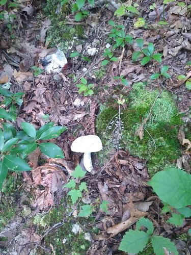
The trail was well canopied, which kept us shaded on this sunny day. Only one real view spot, but the forest was lovely. Over the second half of th hike we encountered several ladders which were needed to get over barbed wire fencing. The last mile of this hike was through open pasture.
Event photos (1)
Reactions
Log in to react to this trip report.
About this event
This hike will travel south from highway VA 610 to VA 617, just above Atkins, beginning at 2600 feet of elevation and 9.0 miles in length.
We begin our hike with a big ascent of Big Walker Mountain with switchbacks beginning almost immediatly. At 0.7 miles we will cross a stream and then reach the crest of Big Walker Mountain and Tilson Gap at 3500 feet 1.5 miles into the hike. The descent begins at Tilson Gap and bottoms out in Crawfish Valley and Reed Creek (2600 feet) at 3.2 miles. From Reed Creek we begin a steep ascent to Little Bushy Mountain 3300 feet). The crest is at 4.3 miles. And a view of the Great Valley at 5.4 miles.
At 7.0 miles in a sag between two ridges is a good place to rest before beginning a 250 ft. ascent. At 7.5 miles we reach the Davis Path Shelter. Another rest stop. A gradual descent here brings us to VA 617 and the end of the hike and 2450 feet of elevation.
The Tennessee Valley Divide marks the division of two watersheds. The Tennessee and the New River. As the AT crosses Reed Creek it is meandering over the Tennessee Valley Divide. When the North Holston River meets the other two forks it dumps into the Tennessee River and enters the Ohio River in Kentucky. The New River cuts northwest past Pearisburg, Va. and flows into the Kanasha River in West Virginia. That river enters the Ohio River 500 miles upstream of the Tennessee.
This will be a one-way hike and will require an auto shuttle.
Plan on spending 6 to 7.5 hours on the hike
Who came along (1)
 GUEST MEMBER
Comments
No comments yet.
Log in to join the conversation.