
Appalachian Trail Hike - lemon Gap to Hot Springs
This was a nice 14.25 mile hike on a cloudy day.
The trip report
Written by dnaturist
There were two of us on this hike.
The hike starts with two fairly gradual ascents from Lemon Gap. The first brought us to Walnut Mountain and a fairly open field with the only views of the day. Limited views at that. After a short descent to Kale Gap we ascended to Bluff Mountain (4686 ft.) at 4 miles, the highest point on the hike.
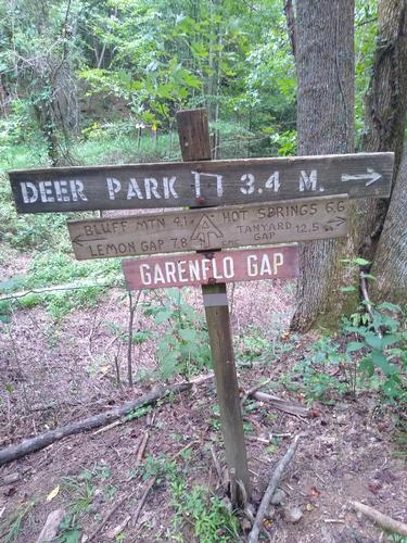
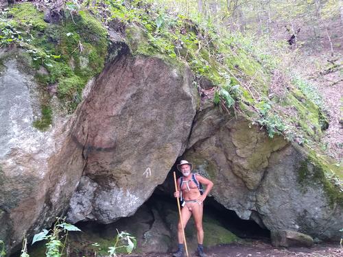
From Bluff Mountain we began a long gradual descent, about 3.8 miles, to Garenflo Gap. On this descent we came upon some nice rock formations and a nice little cave. At this gap was a forest service road and a campsite. It was a good place to rest and have lunch.
Leaving the gap we had a couple of easy ascents before making a long gradual descent into Hot Springs. The end of the hike brought us to the back door of our hostel (Laughing Heart Hostel) and some cold beers.
This was a nice hike in which we challenged the rain gods and won. It rained before us on the trail, but we remained dry for this hike. We were on the trail for 7 hours and 13 minutes for this hike.
Event photos (7)

Reactions
Log in to react to this trip report.
About this event
The hike from Lemon Gap to Hot Springs will be strenuous due to its length of 14 miles. It will be a one-way south to north hike on the Appalachian Trail. The hike will end near the Laughing Heart Hostel in Hot Springs. Plan to spend 8.5 hours on the trail.
The hike will run along the Tennessee/North Carolina border through the Bald Mountains, an irregular range between the Nolichucky and Pigeon Rivers. The open woods on this hike are mostly on ridge tops. Expect our friends, the stinging nettles, to accompany us at the beginning of this walk.
From Lemon Gap we begin our ascent to Walnut Mountain (4280 ft). A gain of 520 ft. From there the trail will drop into Kale Gap which is at the 2 mile mark of the hike. From Kale Gap we begin our ascent to Bluff Mountain (4686 ft), the highest point on the hike. A gain of 986 ft. We reach the summit of Bluff Mountain at the 3.7 mile mark. There are no views here.
From Bluff Mountain we begin a long descent, of 3.7 miles, to Garenflo Gap.The descent is steep at first. This Gap is about 7.5 miles into the hike.From this gap we take a few mild up hill walks before descending to Gragg Gap and the Deer Park Shelter, at about the 10.8 mile mark. After a slight rise, we begin our descent to Hot springs, about 3.2 miles We will have view of Hot Springs and the French Broad River.
The French Broad River gets its name for explorers in the 1700's who saw this broad river flowing towards the French lands, to the west.
There are beds available in Hot Springs at the Laughing Heart Hostel This hike will end near the hostel.
Who came along (2)
 GUEST MEMBER
  GUEST MEMBER
Comments
Log in to join the conversation.