
The trip report
Our hike in the Blue Hills could not have gone better. The weather was good - a mix of overcast and sunny skies with moderate temperatures. The route was challenging, with lots of climbing and some tricky footing, but the hikers put in a great effort and kept their spirits high throughout. The hilltop vistas were very rewarding.
Event photos (2)
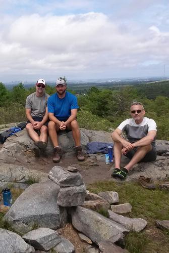
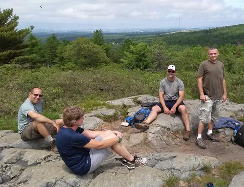
Reactions
Log in to react to this trip report.
About this event
Join Jim and I for a vigorous hike in the Blue Hills reservation. This large (6,000+ acre) preserve is located just 20 minutes south of Boston, alongside the Route 128 beltway, yet is surprisingly scenic and natural. Featuring many hills and rugged sections, it is a popular place to build fitness and train for mountain hiking.
This 6.5 mile hike includes several sections of the Skyline Trail, a rocky path atop the forested ridgeline of the reservation. Our route features many short, steep ascents and descents, with a total elevation gain of about 1750 feet. The terrain is often rocky, with some exposed ledges, so hiking shoes or boots are recommended. Total time will be 4 hours or so. Bring lunch and at least 2 liters of water. Sunscreen and bug repellant are also a good idea.
We begin at the park headquarters at 695 Hillside Street, in the center of the reservation. The hike is divided up into four sections of about 1.5 miles and 45 minutes each, with short breaks in between, including one for lunch. The first leg of the hike goes west along the South Skyline trail, to the top of Great Blue Hill. Here we will stop at the Eliot observation tower, which offers a nice view of downtown Boston in the distance. Next we head east along the North Skyline trail, back to park headquarters. This is the halfway point of the hike; we will have another short break to refill water bottles and use the restroom if needed. Next we proceed east along the somewhat easier Red Dot Trail, to the top of Buck Hill. Here we will take a lunch break and enjoy the summit's 360 degree view of greater Boston and the ocean beyond. The last leg of our hike follows another rugged section of the Skyline Trail, back to park headquarters.
Who came along (2)
 GUEST MEMBER
  GUEST MEMBER
Comments
No comments yet.
Log in to join the conversation.