
Granite Mountain, Prescott AZ
good weather, physical hike, good company
The trip report
good weather, physical hike, good company
Event photos (2)
Reactions
Log in to react to this trip report.
About this event
|
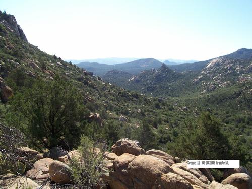
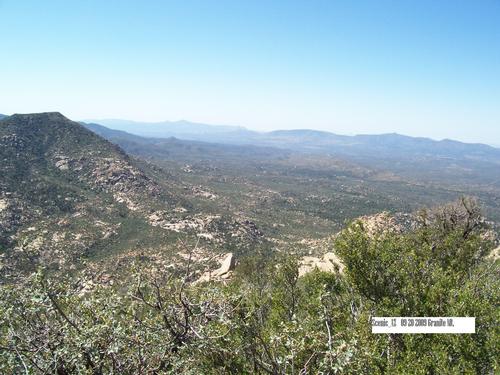
Hike Location- Prescott AZ, Granite MT. / Duration - of the hike will be approx 4 hours total time, we will leave the trailhead at 9:10am. The side road to Granite Mountain branches north off the Iron Springs Road, 4.5 miles from Prescott town center. This enters the Prescott National Forest, the road continues another mile before ending in a one-way loop past a day use area, a boat launch (for the small, man-made Granite Basin Lake) and a carpark (the 3rd day use parking lot This is where we will be meeting for the hike) for the Metate Trailhead, starting point for several paths. This site has trail maps, rest rooms, and a self-pay fee station - there is a small fee for day use I think it's $3.00 now. The Trail: The path to the top of the mountain (TR#261) starts by descending through a thin belt of trees into a low valley, course of a seasonal stream feeding the lake, then re-enters the forest, soon passing a fence, gate and trail register marking the edge of the wilderness area. The well used trail continues quite straight alongside a dry wash, gradually climbing, as the vegetation changes. Large granite boulders start to appear and the land opens out revealing views of Little Granite Mountain on one side and the steep southern cliffs of the main peak to the other. The cliffs and the area beneath are home to an endangered population of peregrine falcons. At Blair Pass after 1.5 miles, the path reaches a second fence and a junction with trails #39 (Cedar Spring) and #37 (Little Granite Mountain), where the route to the summit turns right and begins to ascend the southern slopes. The total elevation gain for this next section is 900 feet over one mile via many switchbacks, though this is a relatively easy climb, never particularly steep, on a firm surface of stone and hard earth, and quite shaded from early to mid morning when the sun is hidden behind the mountain. The walk to the summit will reward the hiker with an unobscured 360 degree view over the surrounding wooded hills. Much of Prescott is visible, 6 miles away, plus Granite Basin Lake and countless square miles of distant, desert land. The walk to this summit is 5 miles, gains 2,000 feet and takes about 2.5 hours one way. directions when coming from the Phoenix area; Exit I-17 at Cordes Junction (Hwy 69) head west toward Prescott, when you get close to Downtown Prescott you will come to a intersection that branches off in several directions, you'll want to stay in the lane marked Gurley rd (89) basically if you don't do anything but drive you will end up on this road. Once on Gurley(89) stay on it until you are past the town square then Look for Grove. You will want to turn right on Grove, Grove will automatically turn into Miller Valley Rd for no apparent reason. Stay on Miller Valley Rd until you come to Iron Springs Rd, turn left on Iron Springs Rd. and take it to N. Granite Basin RD. (there is a sign for Granite Basin Recreation Area as well). Turn Right on N. Granite Basin Rd, and take it all the way to the end. The road dead ends into the campground / day use area. From here just follow the road around until you pass Granite Basin Lake (it's more of a pond) there will be a day use area just past the boat launch ramp, that is where we will be meeting. I will be in either a red and white vintage VW Bus, or a chopped top 57 VW hotrod, both my cars are very identifiable. Cheers |
Who came along (1)
 GUEST MEMBER
Comments
No comments yet.
Log in to join the conversation.