
Mount Lafayette and Franconia Ridge Trail Loop
Hike to one of the most magnificent peaks in the White Mountains!
Mount Lafayette and Franconia Ridge Trail Loop
Hike to one of the most magnificent peaks in the White Mountains!
Details
Weather for 10/22/2024 calls for an Indian summer day. Let's enjoy it with a fall hike.
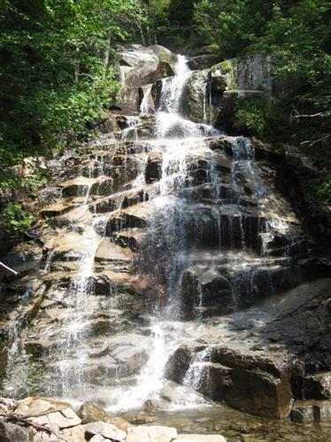
Mount Lafayette [5,260'], located just east of I-93 in Franconia Notch, is the crown jewel of the Franconia Ridge and the highest peak outside the Presidential Range. It is the sixth highest peak in New Hampshire's White Mountains and one of the most magnificent for hiking due to its dramatic ridge above treeline, excellent views and gorgeous waterfalls/cascade on the Falling Waters Trail.
The favorite method of hiking Mount Lafayette is the Franconia Ridge traverse which consists of a loop hike linking 3 summits [Lafayette, Lincoln [5089'] and Little Haystack [4780']. The itinerary starts and ends at Lafayette Place, the trailhead for the Old Bridle Path and Falling Waters Trail. Hiking north to south we will start at Lafayette Place [1780'] and head up the Old Bridle Path reaching Greenleaf Hut [4220'] in 2.9 miles.
From there we continue east 1.1 miles on the Greenleaf Trail to the summit of Mt. Lafayette. Leaving the summit, we travel south on the dramatic Franconia Ridge Trail 1.7 miles up and over Mount Lincoln and then to Little Haystack Mountain [4780']. We then hike down 3.2 miles on the Falling Waters Trail taking time to gaze at its amazing waterfalls and cascades back to Layatte Place.
This hike is rated strenuous because of its length, elevation gain and exposure above treeline. It's recommended for experienced hikers only. We recommend you carry at least 3 liters of water, lunch, snacks, light fleece, and rain protection.
Approximate length is 8.9 miles with 3,900' elevation gain. We will break for lunch at the summit.
We meet at 8:50am for a sharp 9:00am departure.
Hike description from alltrails: https://www.alltrails.com/explore/trail/us/new-hampshire/mount-lafayette-and-franconia-ridge-trail-loop.
Rain cancels.
Directions
Use the following link in google map: https://www.google.com/maps/search/Franconia+Notch
Driving north on I-93 entering the Franconia Notch Parkway, note your mileage as you pass Exit 34A. Continue on the parkway for about 4 miles to an exit with signs for Trailhead Parking. If you are driving south on the Parkway, take the exit for the Lafayette Place Campground and Trailhead Parking, about 2 miles south of Exit 34B for the Cannon Mountain Tramway. A pedestrain underpass connects parking on either side of the parkway.
About this event
Weather for 10/22/2024 calls for an Indian summer day. Let's enjoy it with a fall hike.
Mount Lafayette [5,260'], located just east of I-93 in Franconia Notch, is the crown jewel of the Franconia Ridge and the highest peak outside the Presidential Range. It is the sixth highest peak in New Hampshire's White Mountains and one of the most magnificent for hiking due to its dramatic ridge above treeline, excellent views and gorgeous waterfalls/cascade on the Falling Waters Trail.
The favorite method of hiking Mount Lafayette is the Franconia Ridge traverse which consists of a loop hike linking 3 summits [Lafayette, Lincoln [5089'] and Little Haystack [4780']. The itinerary starts and ends at Lafayette Place, the trailhead for the Old Bridle Path and Falling Waters Trail. Hiking north to south we will start at Lafayette Place [1780'] and head up the Old Bridle Path reaching Greenleaf Hut [4220'] in 2.9 miles.
From there we continue east 1.1 miles on the Greenleaf Trail to the summit of Mt. Lafayette. Leaving the summit, we travel south on the dramatic Franconia Ridge Trail 1.7 miles up and over Mount Lincoln and then to Little Haystack Mountain [4780']. We then hike down 3.2 miles on the Falling Waters Trail taking time to gaze at its amazing waterfalls and cascades back to Layatte Place.
This hike is rated strenuous because of its length, elevation gain and exposure above treeline. It's recommended for experienced hikers only. We recommend you carry at least 3 liters of water, lunch, snacks, light fleece, and rain protection.
Approximate length is 8.9 miles with 3,900' elevation gain. We will break for lunch at the summit.
We meet at 8:50am for a sharp 9:00am departure.
Hike description from alltrails: https://www.alltrails.com/explore/trail/us/new-hampshire/mount-lafayette-and-franconia-ridge-trail-loop.
Rain cancels.
Directions to the trailhead
Get directionsUse the following link in google map: https://www.google.com/maps/search/Franconia+Notch
Driving north on I-93 entering the Franconia Notch Parkway, note your mileage as you pass Exit 34A. Continue on the parkway for about 4 miles to an exit with signs for Trailhead Parking. If you are driving south on the Parkway, take the exit for the Lafayette Place Campground and Trailhead Parking, about 2 miles south of Exit 34B for the Cannon Mountain Tramway. A pedestrain underpass connects parking on either side of the parkway.
Who's going (1)
 SUSTAINING
 Questions about this event?
Reach out to the host, Helvetic Hiker, for route details, carpooling, or what to bring.
Email the hostYou can also ask in the event discussion below.
Event discussion
No comments yet.
Log in to join the conversation.