
Carter Dome and Mt. Hight Hike
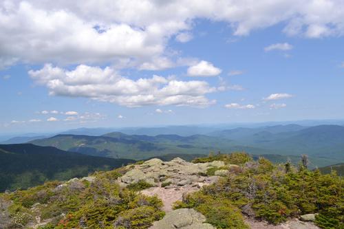
Hiking on a White Mountain 4,000 footer! Presidential views from the top of Mt. Hight.
Carter Dome and Mt. Hight Hike
Hiking on a White Mountain 4,000 footer! Presidential views from the top of Mt. Hight.
Details
Experience beautiful fall views on a White Mountain 4,000 footer! Presidential views from the top of Mt. Hight.
Hike up beautiful Nineteen Mile Brook trail, take the Carter Dome Trail to Zeta Pass and first ascend to Mt. Hight with its bare rock summit that affords incredible views..the best in the entire Carter-Moriah Range! Then we'll continue to tag Carter Dome [4832'], descend steeply down to the environs of Carter Notch and then have an easy 4 mile downhill walk back to the trailhead.
See: https://www.alltrails.com/trail/us/new-hampshire/carter-notch-hut-dome-and-19-mile-brook-trail Length. 9.6 miles Elevation gain 3,543 feet
Directions
Follow New Hampshire Route 16 north through Pinkham Notch. The trailhead parking area is on the right [east] side of the highway exactly 1.0 mile north of the entrance to the Mount Washington auto road.
About this event
Experience beautiful fall views on a White Mountain 4,000 footer! Presidential views from the top of Mt. Hight.
Hike up beautiful Nineteen Mile Brook trail, take the Carter Dome Trail to Zeta Pass and first ascend to Mt. Hight with its bare rock summit that affords incredible views..the best in the entire Carter-Moriah Range! Then we'll continue to tag Carter Dome [4832'], descend steeply down to the environs of Carter Notch and then have an easy 4 mile downhill walk back to the trailhead.
See: https://www.alltrails.com/trail/us/new-hampshire/carter-notch-hut-dome-and-19-mile-brook-trail Length. 9.6 miles Elevation gain 3,543 feet
Directions to the trailhead
Get directionsFollow New Hampshire Route 16 north through Pinkham Notch. The trailhead parking area is on the right [east] side of the highway exactly 1.0 mile north of the entrance to the Mount Washington auto road.
Who's going (3)


Questions about this event?
Reach out to the host, baezfred, for route details, carpooling, or what to bring.
Email the hostYou can also ask in the event discussion below.
Event discussion
Length. 9.6 miles
Elevation gain 3,543 feet
Log in to join the conversation.