
ANNUAL NAKED SOLSTICE HIKE: LONG TRAIL VERMONT
Celebrate National Naked Hike Day on 6/20
ANNUAL NAKED SOLSTICE HIKE: LONG TRAIL VERMONT
Celebrate National Naked Hike Day on 6/20
Details
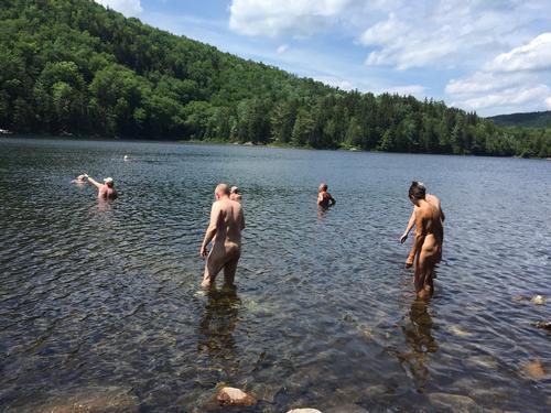
We will be joining a mixed group that has been doing this hike for years. The total distance covered is approximately 10 miles, should take about 6 hours with stopping for lunch and an afternoon swim, and the elevation gain is approximately 1,300 feet, all within the first 3-4 miles, downhill or after that. We will meet at the trailhead parking lot for the Long Trail on Forest Road 10 east of Mt Tabor at 9:00 am. From there, we will leave some cars at the trailhead and carpool to the trailhead parking lot on Route 140 approximately 3 miles east of Wallingford. Once everyone is ready, the hike will commence. The trail leaves the western side of the parking lot and in a short distance, the trail crosses Route 140. A short distance from there, the trail reaches the Roaring Brook Bridge. After crossing the bridge, the trail ascends beside a dramatic gulch and then enters the White Rocks Recreation Area. Shortly thereafter, the trail crosses Bully Brook. The trail then ascends at a moderate grade and passes the trail junction with the Keewaydin Trail. The trail continues to ascend at a moderate grade and passes the trail junction for the Greenwall Spur. In about half a mile, the trail reaches the junction with the White Rocks Cliff Trail which leads downhill .2 miles to a vista from the top of White Rock Cliffs, where we will stop for lunch. After lunch, we traverse the .2 miles back to the Long Trail where the trail ascends further and passes just to the west of White Rocks Mountain. The trail then begins a steady descent and intersects with the old South Wallingford-Wallingford Pond Road and the crosses the Homer Stone Brook Bridge and later intersects with the Green Mountain Trail. In a short distance, the trail reaches Long Pond and follows it’s eastern shore to the Little Rock Pond Shelter where we will stop for a swim. After the swim, we will continue down the trail which in a short distance intersects with the Little Rock Pond Loop Trail at the southern end of Little Rock Pond. The trail continues almost level and in 1.5 miles crosses Little Black Branch over large rocks and shortly after, crosses it again over an I-beam bridge. The trail then follows an old woods road and shortly reaches Forest Road 10, which we cross to the trailhead parking lot. We stop to rest in the parking lot after which we carpool back to Wallingford to pick up the cars parked there. After the hike, those interested can meet at Sam's Wood-fired Pizza, 4478 Main St, Manchester VT, for dinner.
Directions
From US Route #7 in Danby head east on Brooklyn Road (right if heading north, left if heading south). Pass through the town of Mt. Tabor after which the road turns into Forest Road 10. Continue on Forest Road 10 passing the Big Branch picnic area and in a short distance, there will be a large paved parking lot on the right (3.2 miles from the junction of US Route #7). Pull in and park.
Latitude
43.3725862501
Longitude
-72.9626840731
About this event
We will be joining a mixed group that has been doing this hike for years. The total distance covered is approximately 10 miles, should take about 6 hours with stopping for lunch and an afternoon swim, and the elevation gain is approximately 1,300 feet, all within the first 3-4 miles, downhill or after that. We will meet at the trailhead parking lot for the Long Trail on Forest Road 10 east of Mt Tabor at 9:00 am. From there, we will leave some cars at the trailhead and carpool to the trailhead parking lot on Route 140 approximately 3 miles east of Wallingford. Once everyone is ready, the hike will commence. The trail leaves the western side of the parking lot and in a short distance, the trail crosses Route 140. A short distance from there, the trail reaches the Roaring Brook Bridge. After crossing the bridge, the trail ascends beside a dramatic gulch and then enters the White Rocks Recreation Area. Shortly thereafter, the trail crosses Bully Brook. The trail then ascends at a moderate grade and passes the trail junction with the Keewaydin Trail. The trail continues to ascend at a moderate grade and passes the trail junction for the Greenwall Spur. In about half a mile, the trail reaches the junction with the White Rocks Cliff Trail which leads downhill .2 miles to a vista from the top of White Rock Cliffs, where we will stop for lunch. After lunch, we traverse the .2 miles back to the Long Trail where the trail ascends further and passes just to the west of White Rocks Mountain. The trail then begins a steady descent and intersects with the old South Wallingford-Wallingford Pond Road and the crosses the Homer Stone Brook Bridge and later intersects with the Green Mountain Trail. In a short distance, the trail reaches Long Pond and follows it’s eastern shore to the Little Rock Pond Shelter where we will stop for a swim. After the swim, we will continue down the trail which in a short distance intersects with the Little Rock Pond Loop Trail at the southern end of Little Rock Pond. The trail continues almost level and in 1.5 miles crosses Little Black Branch over large rocks and shortly after, crosses it again over an I-beam bridge. The trail then follows an old woods road and shortly reaches Forest Road 10, which we cross to the trailhead parking lot. We stop to rest in the parking lot after which we carpool back to Wallingford to pick up the cars parked there. After the hike, those interested can meet at Sam's Wood-fired Pizza, 4478 Main St, Manchester VT, for dinner.
Directions to the trailhead
Get directionsFrom US Route #7 in Danby head east on Brooklyn Road (right if heading north, left if heading south). Pass through the town of Mt. Tabor after which the road turns into Forest Road 10. Continue on Forest Road 10 passing the Big Branch picnic area and in a short distance, there will be a large paved parking lot on the right (3.2 miles from the junction of US Route #7). Pull in and park.
Latitude
43.3725862501
Longitude
-72.9626840731
Who's going (5)
 GUEST MEMBER
  GUEST MEMBER
  GUEST MEMBER
 Questions about this event?
Reach out to the host, OtisSpunkmeyer, for route details, carpooling, or what to bring.
Email the hostYou can also ask in the event discussion below.
Event discussion
Log in to join the conversation.